

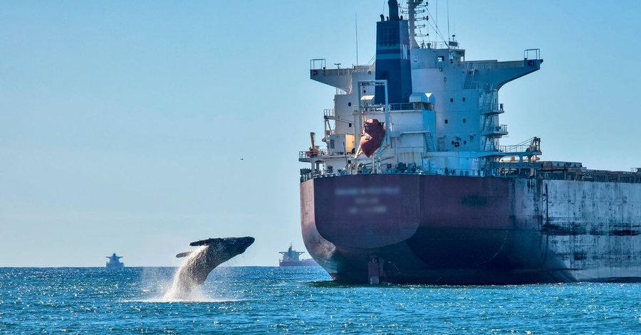
The World Shipping Council (WSC) has unveiled the third edition of its Global Whale Chart, a voyage-planning tool designed to help ship operators minimise collisions between vessels and whales while reducing underwater noise pollution.
What the new edition includes
The updated Whale Chart compiles all known mandatory and voluntary measures worldwide aimed at protecting whales — including slower-speed zones, routing measures, and seasonal or geographic whale-protection areas.
It also adds new data covering regions such as the U.S. West Coast, southern British Columbia, and several updated protection zones in Europe and Asia.
The chart remains freely available to the global maritime community and will continue to be updated as new regulatory or voluntary measures are introduced.
Why this matters for maritime operations
Collisions between vessels and whales, known as ship strikes, pose a significant threat to whale populations, particularly in areas where busy shipping lanes overlap with whale migration or feeding grounds.
The Whale Chart helps ship operators and voyage planners to:
- Identify zones where speed reductions or course adjustments are recommended.
- Review both mandatory and voluntary measures relevant to their voyages.
- Integrate whale-protection planning into voyage-routing and daily operations.
In practical terms, this means that ship masters and navigators can plan routes with environmental risk in mind, balancing voyage efficiency, fuel savings, and wildlife protection.
Implications for surveyors, ship operators, and maritime service providers
For organisations such as Observater Surveys and Services Limited and their clients, the implications are clear:
- Voyage planning and compliance: Shipowners are expected to demonstrate that voyage-planning tools consider environmental and wildlife risks. Survey and consultancy firms may play a role in verifying these compliance steps.
- Risk reduction: Avoiding whale strikes helps reduce insurance liabilities, reputational damage, and environmental fines.
- Regional expertise: Some ports and coastal states may impose additional reporting or speed restrictions. Service providers with local knowledge can support shipowners in meeting these requirements.
- Crew training: Raising awareness among bridge teams about whale-strike zones and seasonal protection measures is now part of best practice for safe and responsible operations.
Challenges and next steps
While the chart is a valuable resource, there are still challenges:
- Integration into onboard systems like electronic chart displays and voyage-planning software is essential for real-time application.
- Compliance with voluntary measures depends on operator commitment and regional enforcement.
- The chart is informational and does not replace official navigation warnings or national maritime notices.
- As global shipping expands — including into sensitive regions such as the Arctic — continuous updates, data sharing, and monitoring will be required.
Industry reaction
Major shipping lines and environmental groups have welcomed the update, seeing it as a step forward in balancing trade efficiency with marine ecosystem protection. Industry stakeholders emphasise that collaboration between carriers, regulators, and conservationists will be key to reducing whale strikes on a global scale.
Outlook
With this third edition, the shipping industry gains an enhanced tool for integrating marine-life protection into daily operations. For surveyors and maritime service firms, it presents new opportunities to help clients meet environmental standards, improve route planning, and demonstrate responsible shipping practices.
As sustainability and biodiversity protection become central to maritime policy, such tools will increasingly define the standard for environmentally sound navigation worldwide.
Tell us What is Happening in Your Area: Contact Maritime Context at: news@maritimecontext.com
